Tuvalu
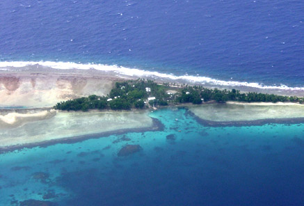
Geography
Land Use
People
Economy
Water Statistics
|
Status of Water Resources
Rainfall and rainwater harvesting is the primary source of water supply in Tuvalu. In the early 1980s most families took advantage of an aid project for provision of ferro-cement storage tanks attached to small areas of roofing sheets providing the catchment and shelter for an external kitchen area. The tanks had an approximate capacity of 3.6 m³ and were intended only to meet drinking water demands. However once supplied, usage increased and the available water quickly depleted.
Rainwater harvesting: Primary source of water supply
Groundwater: Available on all islands
Problems with Water Resources and Associated Environment Issues
The majority of islands have wells. Some wells are just holes dug down to the groundwater lens and are not protected from contamination and pollution. However within the villages most wells are protected by coral stone walls, capped and provided with hand pumps (diaphragm type) with latrines often adjacent. Water quality is often poor.
Well water is now seldom used for drinking and it is has been observed that during periods of low rainfall the quality can deteriorate, and becomes more saline. Groundwater is used for domestic needs in the outer islands as an emergency supply in times of drought. Over-extraction in 1999 and 2000 resulted in groundwater becoming brackish/salty, the water level dropped with serious consequences for the vegetation as witnessed in Vaitupu.
On many of the islands groundwater is available under the villages, which is probably why the villages were originally settled in that location. However because of the extensive use of pit latrines and septic tanks the water is contaminated and its use can lead to disease. On Funafuti groundwater is only used for feeding pigs, washing pig pens and flushing toilets. During droughts its use extends to washing clothes, bathing and flushing toilets.
Diagnostic Report
Demonstration Proposal
Hot Spot Analysis
Information on this page obtained from Integrated Water Resources Management programme's Diagnostic Reports (SOPAC 2007)
© 2024 SPC Water, Sanitation and Hygiene. All rights reserved.