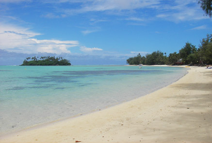
GEOSCIENCE DIVISION
Map Cook Islands Federated Sates of Micronesia Fiji Kiribati Nauru Niue Papua New Guinea Republic of Marshall Islands Republic of Palau Samoa Solomon Islands Tonga Tuvalu Vanuatu
Country
Population
Land Area
Climate
Water resource
Water consumption
Country Cook Islands Cook Islands
Population 21,750 (July 2007 est.)
Land Area 236.7 km2
Climate
Water resource
Water consumption
Country Federated Sates of Micronesia Federated Sates of Micronesia
Population 107,862 (July 2007 est.)
Land Area 702 km2
Climate
Water resource Avg Rainfall: 4,928 mm per annum
Water consumption
Country Fiji Fiji
Population 918 675 (July 2007 est.)
Land Area 18,270 km2
Climate
Water resource Avg Rainfall: 2000 - 3000 mm per annum
Water consumption
Country Kiribati Kiribati
Population 107,817 (July 2007 est.)
Land Area 811 km2
Climate
Water resource Avg Rainfall: South of the equator: 1,300 mm Tarawa: 2,000 mm Northernmost islands: over 3,200mm Eastern Line Islands: less than 1,000 mm
Water consumption
Country Nauru Nauru
Population 11,528 (July 2007 est.)
Land Area 21 km2
Climate
Water resource Avg Rainfall: 2,090 mm per annum
Water consumption
Country Niue Niue
Population 1,625m(GoN statistics 2006)
Land Area 260 km2
Climate
Water resource Avg Rainfall: 2,180 mm per annum
Water consumption
Country Papua New Guinea Papua New Guinea
Population 5,795,887 (July 2007 est.)
Land Area 462,840 km2
Climate
Water resource Avg Rainfall:1000-80000 mm per annum
Water consumption
Country Republic of Marshall Islands Republic of Marshall Islands
Population 20,842
Land Area 458 km2
Climate
Water resource Avg Rainfall: 3,700 mm per annum
Water consumption
Country Republic of Palau Republic of Palau
Population 61,815(July 2007 est.)
Land Area 11,854.3 km2
Climate
Water resource Avg Rainfall: Southern attols: 4,000mm Northern attols:2,000 mm per annum
Water consumption
Country Samoa Samoa
Population 214,265
Land Area 2,944 km2
Climate
Water resource Avg Rainfall: 3,000 mm per annum
Water consumption
Country Solomon Islands Solomon Islands
Population 566,842
Land Area 28,450 km2
Climate
Water resource Avg Rainfall:1500-5000 mm per annum
Water consumption
Country Tonga Tonga
Population 116,921
Land Area 748 km2
Climate
Water resource Avg Rainfall: Varies from north and south of tonga with an estimated average of 2500 mm per annum
Water consumption
Country Tuvalu Tuvalu
Population 11.992 (July 2007 est.)
Land Area 26 km2
Climate
Water resource Avg Rainfall: 3000mm per annum
Water consumption
Country Vanuatu Vanuatu
Population 211,971 (July 2007 est.)
Land Area 12,200 km2
Climate
Water resource Avg Rainfall: 2000 - 4000 mm per annum
Water consumption
Theme
Key Message
Action
Project Title
Implementing Agency
Partnership Organisation
Location
Status
Donor Agency
Keywords
("," separated)
Cancel
Click here to add a new record to the Pacific Water Action Matrix.
View the map for more country information.
Cook Islands
Geography
Total Area 236.7 km2
Land 236.7 km2
Water 0 km2
Highest Elevation 652 m 

Land Use
Arable 16.67%
Perm. Crop 8.33%
Other 75% (2005)

People
Population 21,750 (July 2007 est.)
Population Growth Rate 1.2% between 1996 - 2001 (2001 census)

Economy
GDP per capita (PPP) $12,878 (2005 est.)

Water Statistics
Avg Rainfall

2,040 mm per annum.
Cook Islands

Status of Water Resources


The Cook Islands sources its water from two main sources. In the Southern Group of islands which includes the main island of Rarotonga, surface water is sourced from springs and streams within catchments valleys, while in the Northern Group of islands, water is sourced from rainwater and groundwater as the islands are coral atolls. Freshwater lens are present, however, the past practice of manually extracting water from wells have been abandoned.

In terms of consumption, per capita figures of about 260 litres per capita per day are high for a developing country, and water losses throughout the system are thought to be around 50%.

Problems with Water Resources and Associated Environment Issues

Generally, in comparison to similar Small Island Development States (SIDS) within the Pacific, environmental impacts are few, but the issue of sound water resources management is one of the main issues facing the Cook Islands.
In terms of current water supply system, old steel and galvanised pipes have problems with corrosion and leakage.

During the wet season the water supply is often discoloured and turbid and contains silt, sediment and debris. Thus, the water system at present is vulnerable to any form of disaster, such as contamination from agriculture chemicals, sanitation contamination and saltwater intrusion.

Septic tank systems are widely used throughout Rarotonga, comprising of a septic tank and a soak away. The septic sludge is currently dumped on vacant land, or on fields at the request of planters. There is only one reticulated sewerage system on Rarotonga, it collects sewage from the residents and is fed into septic tanks for treatment. The septic tanks were replaced in 1994 with an Enviroflow proprietary sewage treatment plant. But the plant was neither maintained nor operated correctly, and fell into disuse. The raw sewage currently bypasses the plant and flows into the sea.

The common theme in reviewing the water sector in the Cook Islands is that water management and water sector policy generally is not advanced. There is no single national water supply legislation in place except for scattered provisions that address the supply of water to the public such as the Rarotonga Waterworks Ordinance of 1960. In the absence of such a framework, water supply projects especially on the outer islands have been historically implemented without full assessment of their viability, sustainability and impact on the local community and environment.

Finally, there is a lack of commercialisation within the water sector – water is provided free in Rarotonga – and there is generally a lack of capacity and expertise including human and technical resources in the water sector, both government and private sector.

Diagnostic Report
Demonstration Proposal
Hot Spot Analysis

Information on this page obtained from Integrated Water Resources Management programme's Diagnostic Reports (SOPAC 2007)