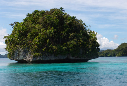
GEOSCIENCE DIVISION
Map Cook Islands Federated Sates of Micronesia Fiji Kiribati Nauru Niue Papua New Guinea Republic of Marshall Islands Republic of Palau Samoa Solomon Islands Tonga Tuvalu Vanuatu
Country
Population
Land Area
Climate
Water resource
Water consumption
Country Cook Islands Cook Islands
Population 21,750 (July 2007 est.)
Land Area 236.7 km2
Climate
Water resource
Water consumption
Country Federated Sates of Micronesia Federated Sates of Micronesia
Population 107,862 (July 2007 est.)
Land Area 702 km2
Climate
Water resource Avg Rainfall: 4,928 mm per annum
Water consumption
Country Fiji Fiji
Population 918 675 (July 2007 est.)
Land Area 18,270 km2
Climate
Water resource Avg Rainfall: 2000 - 3000 mm per annum
Water consumption
Country Kiribati Kiribati
Population 107,817 (July 2007 est.)
Land Area 811 km2
Climate
Water resource Avg Rainfall: South of the equator: 1,300 mm Tarawa: 2,000 mm Northernmost islands: over 3,200mm Eastern Line Islands: less than 1,000 mm
Water consumption
Country Nauru Nauru
Population 11,528 (July 2007 est.)
Land Area 21 km2
Climate
Water resource Avg Rainfall: 2,090 mm per annum
Water consumption
Country Niue Niue
Population 1,625m(GoN statistics 2006)
Land Area 260 km2
Climate
Water resource Avg Rainfall: 2,180 mm per annum
Water consumption
Country Papua New Guinea Papua New Guinea
Population 5,795,887 (July 2007 est.)
Land Area 462,840 km2
Climate
Water resource Avg Rainfall:1000-80000 mm per annum
Water consumption
Country Republic of Marshall Islands Republic of Marshall Islands
Population 20,842
Land Area 458 km2
Climate
Water resource Avg Rainfall: 3,700 mm per annum
Water consumption
Country Republic of Palau Republic of Palau
Population 61,815(July 2007 est.)
Land Area 11,854.3 km2
Climate
Water resource Avg Rainfall: Southern attols: 4,000mm Northern attols:2,000 mm per annum
Water consumption
Country Samoa Samoa
Population 214,265
Land Area 2,944 km2
Climate
Water resource Avg Rainfall: 3,000 mm per annum
Water consumption
Country Solomon Islands Solomon Islands
Population 566,842
Land Area 28,450 km2
Climate
Water resource Avg Rainfall:1500-5000 mm per annum
Water consumption
Country Tonga Tonga
Population 116,921
Land Area 748 km2
Climate
Water resource Avg Rainfall: Varies from north and south of tonga with an estimated average of 2500 mm per annum
Water consumption
Country Tuvalu Tuvalu
Population 11.992 (July 2007 est.)
Land Area 26 km2
Climate
Water resource Avg Rainfall: 3000mm per annum
Water consumption
Country Vanuatu Vanuatu
Population 211,971 (July 2007 est.)
Land Area 12,200 km2
Climate
Water resource Avg Rainfall: 2000 - 4000 mm per annum
Water consumption
Theme
Key Message
Action
Project Title
Implementing Agency
Partnership Organisation
Location
Status
Donor Agency
Keywords
("," separated)
Cancel
Click here to add a new record to the Pacific Water Action Matrix.
View the map for more country information.
Republic of Palau
Geography
Total Area 458 km2
Land 458 km2
Water 0 km2
Highest Elevation 242 m

Land Use
Arable 8.7%
Perm. Crop 4.35%
Other 86.95% (2005)

People
Population 20,842 (July 2007 est.)
Population Growth Rate 1.233% (2007 est.)

Economy
GDP per capita (PPP) $7,600 (2005 est.)

Water Statistics
Avg Rainfall 3,700 mm per annum
   
Republic of Palau


Status of Water Resources

Palau produces 300 billion gallons (1.1 billion cubic metres) of water per year from surface water run-off. The island of Babeldaob has 5 major watersheds with an additional 11 minor watersheds. The Ngerikiil River in Airai supplies 3 million gallons (11,000 cubic metres) a day to the Koror/Airai Water Treatment Plant for use by three-fourths of the population of Palau. The rest of the islands of Palau rely on groundwater sources and rainfall.


Problems with Water Resources and Associated Environment Issues
  • Extent to which groundwater and surface water resources exploited
The Ngerimel Dam decreased water flow into the lower part of its watershed, but the flora and fauna of that area have acclimated to the decreased water levels over the past decades.
  • Use of Alternative Sources
Almost every household has some sort of rainwater catchment system, ranging from simple plastic lined 55-gallon steel barrels to imported aluminium 400 gallon tanks to constructed cement tanks. Desalination has been raised in the past though never thoroughly explored. Store bought water bottles are a popular alternative drinking water source.
  • The various and relative demands placed on watersheds/water resources
Watersheds are heavily relied upon as water sources. The Koror/Airai treatment plant estimates extraction of 4.5 million gallons per day from the Ngerimel Dam and Ngerikiil River, based on amount processed within the plant, not actual amount of intake. However with an expected migration to Babeldaob, increased water usages from the rural public water systems are expected.
  • Competing uses of water and priority uses
Competing uses on the water supply comes from the tourism industry, which diverts hundreds of thousands of gallons. Mangroves and coral reefs are dependent on certain level of freshwater. How water extraction is impacting the coastal environment and the extent to which impounding water has on decreasing fresh water flow to coral reefs is unknown at this time.
  • Sources of pollution of surface water, groundwater and coastal waters
The main source of pollution is sedimentation caused by poor erosion controls, loss of riparian buffers, and poor landuse practices. Pollution into the groundwater sources is from poorly maintained septic tanks, leachate from nearby landfills, etc and also from saltwater intrusion. On the platforms and atolls, there is a need to limit the amount of water extracted per day. Coastal waters are impacted daily from land-based pollution, gasoline and oil from outboard motors and ships. With more development expected on the larger islands, other sources of pollution will be inevitable, i.e. sewage, chemical pollution, oil spill, etc.

Diagnostic Report
Demonstration Proposal
Hot Spot Analysis

Information on this page obtained from Integrated Water Resources Management programme's Diagnostic Reports (SOPAC 2007)