GEOSCIENCE DIVISION
Map Cook Islands Federated Sates of Micronesia Fiji Kiribati Nauru Niue Papua New Guinea Republic of Marshall Islands Republic of Palau Samoa Solomon Islands Tonga Tuvalu Vanuatu
Country
Population
Land Area
Climate
Water resource
Water consumption
Country Cook Islands Cook Islands
Population 21,750 (July 2007 est.)
Land Area 236.7 km2
Climate
Water resource
Water consumption
Country Federated Sates of Micronesia Federated Sates of Micronesia
Population 107,862 (July 2007 est.)
Land Area 702 km2
Climate
Water resource Avg Rainfall: 4,928 mm per annum
Water consumption
Country Fiji Fiji
Population 918 675 (July 2007 est.)
Land Area 18,270 km2
Climate
Water resource Avg Rainfall: 2000 - 3000 mm per annum
Water consumption
Country Kiribati Kiribati
Population 107,817 (July 2007 est.)
Land Area 811 km2
Climate
Water resource Avg Rainfall: South of the equator: 1,300 mm Tarawa: 2,000 mm Northernmost islands: over 3,200mm Eastern Line Islands: less than 1,000 mm
Water consumption
Country Nauru Nauru
Population 11,528 (July 2007 est.)
Land Area 21 km2
Climate
Water resource Avg Rainfall: 2,090 mm per annum
Water consumption
Country Niue Niue
Population 1,625m(GoN statistics 2006)
Land Area 260 km2
Climate
Water resource Avg Rainfall: 2,180 mm per annum
Water consumption
Country Papua New Guinea Papua New Guinea
Population 5,795,887 (July 2007 est.)
Land Area 462,840 km2
Climate
Water resource Avg Rainfall:1000-80000 mm per annum
Water consumption
Country Republic of Marshall Islands Republic of Marshall Islands
Population 20,842
Land Area 458 km2
Climate
Water resource Avg Rainfall: 3,700 mm per annum
Water consumption
Country Republic of Palau Republic of Palau
Population 61,815(July 2007 est.)
Land Area 11,854.3 km2
Climate
Water resource Avg Rainfall: Southern attols: 4,000mm Northern attols:2,000 mm per annum
Water consumption
Country Samoa Samoa
Population 214,265
Land Area 2,944 km2
Climate
Water resource Avg Rainfall: 3,000 mm per annum
Water consumption
Country Solomon Islands Solomon Islands
Population 566,842
Land Area 28,450 km2
Climate
Water resource Avg Rainfall:1500-5000 mm per annum
Water consumption
Country Tonga Tonga
Population 116,921
Land Area 748 km2
Climate
Water resource Avg Rainfall: Varies from north and south of tonga with an estimated average of 2500 mm per annum
Water consumption
Country Tuvalu Tuvalu
Population 11.992 (July 2007 est.)
Land Area 26 km2
Climate
Water resource Avg Rainfall: 3000mm per annum
Water consumption
Country Vanuatu Vanuatu
Population 211,971 (July 2007 est.)
Land Area 12,200 km2
Climate
Water resource Avg Rainfall: 2000 - 4000 mm per annum
Water consumption
Theme
Key Message
Action
Project Title
Implementing Agency
Partnership Organisation
Location
Status
Donor Agency
Keywords
("," separated)
Cancel
Click here to add a new record to the Pacific Water Action Matrix.
View the map for more country information.
Vanuatu
Geography
Total Area 12,200 km2
Land 12,200 km2
Water 0 km2
Highest Elevation  1,877 m

Land Use
Arable 1.64%
Perm. Crop 6.97%
Other 91.39% (2005)

People
Population 211,971 (July 2007 est.)
Population Growth Rate 1.46% (July 2007 est.)

Economy
GDP per capita (PPP) $2,900 (2003 est.)

Water Statistics
Avg Rainfall
2000 - 4000 mm per annum. Wet season from November to April.
 
Vanuatu


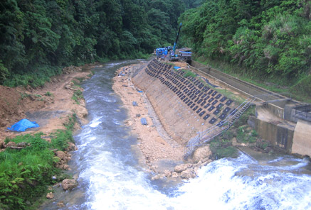
Status of Water Resources
In Vanuatu, both ground and surface water are used for domestic purposes. In urban areas the main water source is shallow aquifers whereas in rural areas various sources are used such as bores, wells, springs, rivers and rainwater catchments.

Urban water supplies are provided by UNELCO (a private company) in Port Vila and Public Works in Luganville, Isangel and Lakatoro. All rural supplies are donor-funded and designed and delivered by either the drilling section or rural water supply (within DGMWR). Rural water supplies are operated and managed by the local community.


Problems with Water Resources and Associated Environment Issues
  • Demands and competing uses of water
Where water extraction is monitored because it is provided as a reticulated supply, then there is some knowledge and observation of the aquifer. In both Port Vila and Luganville aquifers are under increasing pressure from housing, agriculture and other developments. Outside of the demands of the reticulated supply, no formal assessment has been made of demand or impacts of competing use.
  • Groundwater quality and quantity
Information on ground water in Vanuatu is sporadic and mostly focused on Port Vila and Luganville. Groundwater quality in both urban centres of Port Vila and Luganville is generally good with only calcium hardness to note. Neither water supply currently requires treatment other than chlorination. However, in both cases aquifer levels are thought to be decreasing while pumping demands are increasing.
  • Surface water quality and quantity
Information on ground water in Vanuatu is sporadic and mostly focused on Port Vila and Luganville. Groundwater quality in both urban centres of Port Vila and Luganville is generally good with only calcium hardness to note. Neither water supply currently requires treatment other than chlorination. However, in both cases aquifer levels are thought to be decreasing while pumping demands are increasing.
  • Pollution
Scabies, skin diseases and malaria are water related diseases and are the three most common health issues in Vanuatu. Poor drainage and waste management provide pools of water that are favourable breeding sites for malaria mosquito. Unmanaged and uncontrolled sanitation and wastewater are also major concerns.

Diagnostic Report
Hot Spot Analysis

Information on this page obtained from Integrated Water Resources Management programme's Diagnostic Reports (SOPAC 2007)