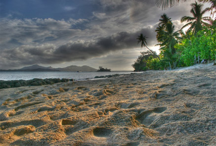
GEOSCIENCE DIVISION
Map Cook Islands Federated Sates of Micronesia Fiji Kiribati Nauru Niue Papua New Guinea Republic of Marshall Islands Republic of Palau Samoa Solomon Islands Tonga Tuvalu Vanuatu
Country
Population
Land Area
Climate
Water resource
Water consumption
Country Cook Islands Cook Islands
Population 21,750 (July 2007 est.)
Land Area 236.7 km2
Climate
Water resource
Water consumption
Country Federated Sates of Micronesia Federated Sates of Micronesia
Population 107,862 (July 2007 est.)
Land Area 702 km2
Climate
Water resource Avg Rainfall: 4,928 mm per annum
Water consumption
Country Fiji Fiji
Population 918 675 (July 2007 est.)
Land Area 18,270 km2
Climate
Water resource Avg Rainfall: 2000 - 3000 mm per annum
Water consumption
Country Kiribati Kiribati
Population 107,817 (July 2007 est.)
Land Area 811 km2
Climate
Water resource Avg Rainfall: South of the equator: 1,300 mm Tarawa: 2,000 mm Northernmost islands: over 3,200mm Eastern Line Islands: less than 1,000 mm
Water consumption
Country Nauru Nauru
Population 11,528 (July 2007 est.)
Land Area 21 km2
Climate
Water resource Avg Rainfall: 2,090 mm per annum
Water consumption
Country Niue Niue
Population 1,625m(GoN statistics 2006)
Land Area 260 km2
Climate
Water resource Avg Rainfall: 2,180 mm per annum
Water consumption
Country Papua New Guinea Papua New Guinea
Population 5,795,887 (July 2007 est.)
Land Area 462,840 km2
Climate
Water resource Avg Rainfall:1000-80000 mm per annum
Water consumption
Country Republic of Marshall Islands Republic of Marshall Islands
Population 20,842
Land Area 458 km2
Climate
Water resource Avg Rainfall: 3,700 mm per annum
Water consumption
Country Republic of Palau Republic of Palau
Population 61,815(July 2007 est.)
Land Area 11,854.3 km2
Climate
Water resource Avg Rainfall: Southern attols: 4,000mm Northern attols:2,000 mm per annum
Water consumption
Country Samoa Samoa
Population 214,265
Land Area 2,944 km2
Climate
Water resource Avg Rainfall: 3,000 mm per annum
Water consumption
Country Solomon Islands Solomon Islands
Population 566,842
Land Area 28,450 km2
Climate
Water resource Avg Rainfall:1500-5000 mm per annum
Water consumption
Country Tonga Tonga
Population 116,921
Land Area 748 km2
Climate
Water resource Avg Rainfall: Varies from north and south of tonga with an estimated average of 2500 mm per annum
Water consumption
Country Tuvalu Tuvalu
Population 11.992 (July 2007 est.)
Land Area 26 km2
Climate
Water resource Avg Rainfall: 3000mm per annum
Water consumption
Country Vanuatu Vanuatu
Population 211,971 (July 2007 est.)
Land Area 12,200 km2
Climate
Water resource Avg Rainfall: 2000 - 4000 mm per annum
Water consumption
Theme
Key Message
Action
Project Title
Implementing Agency
Partnership Organisation
Location
Status
Donor Agency
Keywords
("," separated)
Cancel
Click here to add a new record to the Pacific Water Action Matrix.
View the map for more country information.
Fiji Islands
Geography
Total Area 18,270 km2
Land 18,270 km2
Water 0 km2
Highest Elevation 1,324 m

Land Use
Arable 10.95%
Perm. Crop 4.65%
Other 84.4% (2005)

People
Population 918 675 (July 2007 est.)
Population Growth Rate 1.394% (2007 est.)

Economy
GDP per capita (PPP) $6,200 (2006 est.)

Water Statistics
Avg Rainfall 2000 - 3000 mm per annum
Fiji Islands


Status of Water Resources

Surface water is used as the main source of supply for all major towns on the larger, high islands of Fiji. Some small, low lying islands rely excusively on groundwater and may also harness rainwater. Contamination of the wells in the the small islands may happen due to lack of sanitation and awareness.

A considerable amount of potable water is lost in the reticulation system as a result of background leakage and frequent bursts. Several areas face problems with either too high or too low pressure. The Public Works Department is in need of updated equipment and training.

Problems with Water Resources and Associated Environment Issues

Fiji has numerous small islands, some of which are low in elevation and also inhabited. Surface water availability is a problem in some islands, which rely exclusively on groundwater and may or may not attempt to use rainwater. Rainwater harvesting using roof systems is widespread in Fiji but the psychology of rural people may fail to take into account the possibility of extreme climate events and drought when there is relatively abundant water for most of the time (for instance providing small capacity storage instead of larger capacity).

Some conflicts have occurred over surface water availability. In particular, there are conflicts between water for irrigation and water for other purposes in one or two cases.

Groundwater occurs on both the large islands and small low-lying islands, but the groundwater issues and challenges in these different physical environments differ. Groundwater is found in superficial and medium-depth strata on the larger islands of Viti Levu and Vanua Levu and some large islands, in either fractured rock or sedimentary formations.

Significant groundwater deposits, such as the Nadi Valley coastal aquifer, on the large islands are available and are under pressure for devleopment.

Groundwater resources on small islands play a very different role. There are cases in Fiji of islands with superficial groundwater lenses in sandbeds or coral formations, which lie on marine water and can be readily exhausted. The fragility of superficial groundwater lenses means that they need to be carefully managed.

Diagnostic Report
Demonstration Proposal
Hot Spot Analysis

Information on this page obtained from Integrated Water Resources Management programme's Diagnostic Reports (SOPAC 2007)