


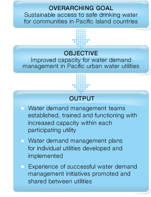
Project goal, objective and outputs
 SOPAC, the Pacific Islands Applied Geoscience Commission, is an intergovernmental organisation based in Suva, Fiji. SOPAC helps member countries to sustainably manage their non-living natural resources. Since mid 2006 SOPAC have been managing the implementation of the New Zealand’s International Aid & Development Agency funded project “Water Demand Management (WDM) for Pacific Island Countries 2006 – 2009”. A partnership with world leading in this field, Wide Bay Water Corporation, was established in early 2007. Together these organisations ensure that state of the art WDM techniques and technologies are being implemented, with sustainable capacity built in participating countries to do so. The program is initially focusing on 5 countries: Cook Islands, Federated States of Micronesia, Marshall Islands, Niue and Solomon Islands, with Vanuatu added as additional country based on an assessment in 2008.
To measure is to know
The main finding during initial scoping missions in 2006 was the lack of data and data collection equipment. To be suited to take the right steps in the future a foundation have been laid for understanding the different water supply systems better through metering and data logging of flow and pressure.
 This data can be analyzed in order to create a water balance. A water balance is the first step in any water loss management project and allows you to have an overview over where your water goes. The water balance will let you understand the key demands on your water, to separate the demands into authorised and unauthorised consumption and it will allow you to make high level predictions about the potential savings that can be made.
In the past, development projects in the water supply sector have mainly concentrated on the upgrading or extension of existing water supply infrastructure. This supply driven approach has proven to be very costly for both the donor and the receiving country and has not led to a safe water supply even for the bigger urban centres in most of the Pacific Islands Countries (PIC). Many of the water supply systems in PIC have problems with water delivery to customers and one of the primary causes is the fact that these systems often loose more water through leakage and wastage than they actually deliver.
With more pressure on limited resources, many PIC have realised that the key towards sustainability lies not necessarily in costly infrastructure extension but rather in the sound management of the water already available. This is the basis of a demand management approach where strategies are developed to improve and optimise existing water supply resources and infrastructure, and encourage customers to use water efficiently. Economic, environmental and social benefits are achievable with such an approach.
